GIS (Digital Mapping)
What Is GIS
Esri
UWGB
American Digital Cartography
Graef, Anhalt, Schloemer
Earth Tech
McMahon
Menominee Indian Tribe of WI
Geographic Information Systems (GIS)
Geographic Information Systems (GIS)

Why GIS?
When I left the Air Force I was not able to preform mechanic duties and decided to go to college. At Bay-Lake Regional Planning Commission we purchased a software program from ESRI called PC ArcInfo 3.5. At the same time at the University of Wisconsin - Green Bay, there was a computer sitting next to the cart lab that also had this software installed, but nobody was using it. I asked to be able to use it for an independent study course. My first project was to digitize all the parcels for the Village of Ashwaubenon. Once I finished this, I used this dataset for two more indendent study courses.
I then moved on to Geographic System Corporation (GSC) working under Bruce Baikie. This job only last as long as it took to write the Oconto County Land Information Modernization Plan and I was let go.
Luckily I was able to land a job at American Digital Cartography in the area of GIS marketing. It was then that I was able to start in the area of data conversion, writing programs to convert Digital Line Graph (DLG), TIGER/Line, and Etak data sources for use in GIS and CAD software. For TIGER files, I used ArcInfo's Arc Macro Language (AML) to convert the raw data into ESRI shapefiles. I was able to work my way up to Director of Technical Services before the company began a major slide and I felt I needed to move on before I was let go.
I took a job as the GIS Coordinator at Graef, Anhalt, Schloemer and Associates, an engineering firm. They didn't have a GIS presence and it was my job to incorporate GIS into their work processes. It didn't take long to find out there was no vision or support for GIS and what was supposed to be my GIS career was over in two years.
I left Graef for Earth Tech in June of 2000 on the word of a former ADC employee. I took the job based on the knowledge that I would be able to participate in many projects, from many offices. This was the farthest thing from the truth. Besides over 25 two week trip to support GeoBase, I never was asked to help support any other projects. My two main clients were the City of Racine and the Stevens Point Water and Sewerage Dept. I acted as their GIS Coordinators and helped develop and maintain the GIS data and web mapping applications. This job lasted for almost 7 years, from which I was let go on a Wednesday after returning from a GeoBase trip on Saturday. Some gratitude for the almost year of travel I did for them, the airplane flights, long hotel stays, and the time away from my family. To this day I maintain a bitter feeling towards the supervisors I had and their pathetic management of the IT department.
After Earth Tech I was able to land a temporary job at McMahon Group, another consulting/engineering firm. As it was only for a short-term project and they would only offer me a job if I was able to bring in a GIS project, I decided to take a job at the Menominee Indian Tribe of Wisconsin. It is here that I have been able to finally develop my true GIS skills, with many projects and all the tools available for me.
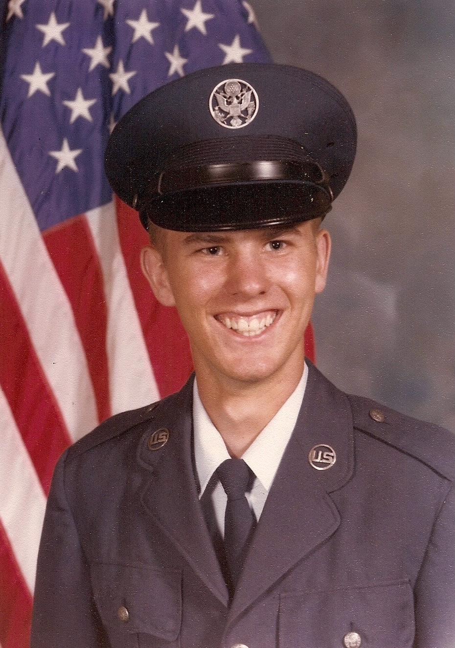
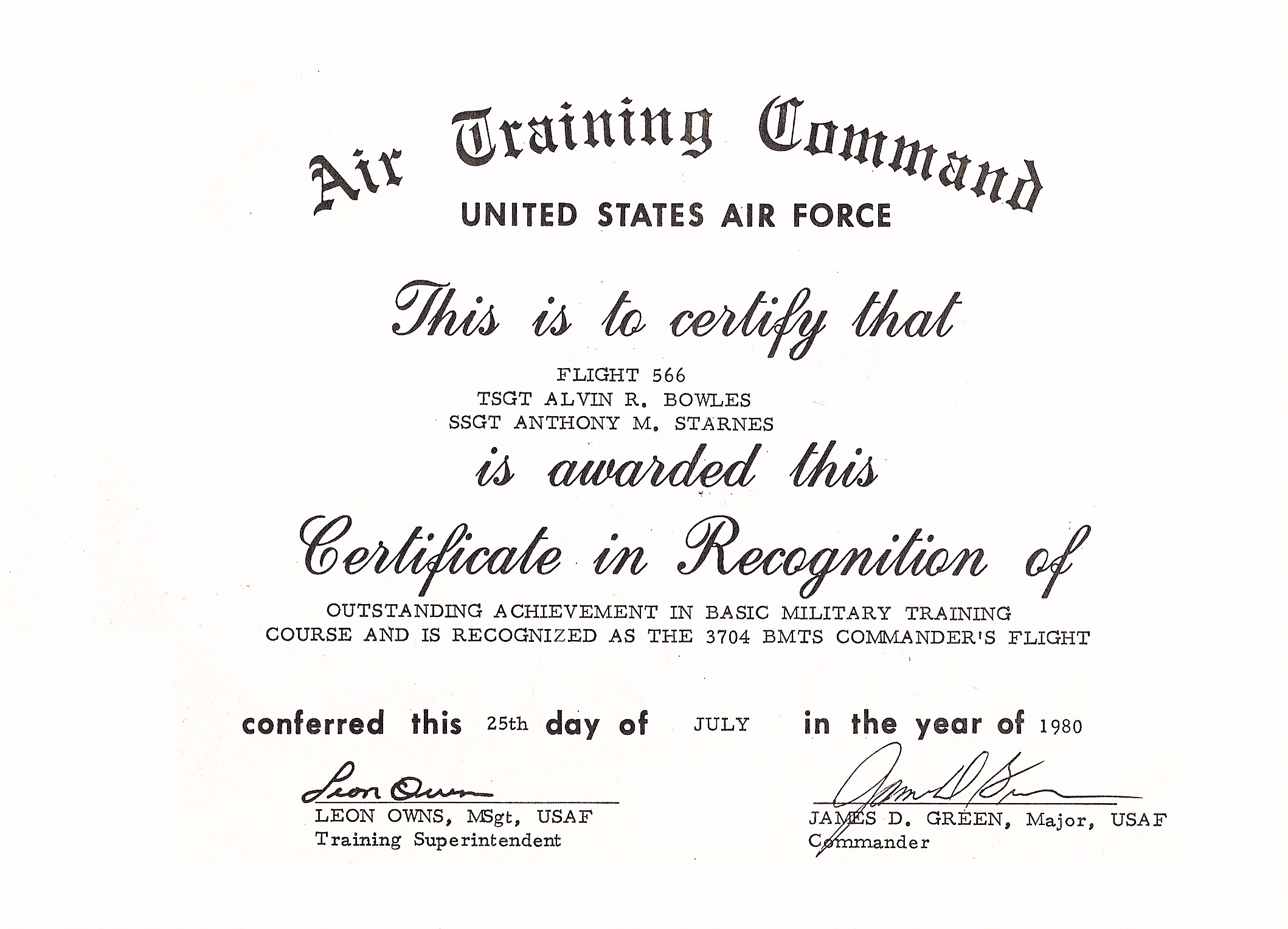
From the gallery
Pictures of my military career.
 |
 |
 |